My PDXWalk app for Android has two primary functions.
November 10, 2022: PDXWalk Lite (beta) is now available via Play Store. Price as of this edit is $2.49. Contains tiny banner ad, but is not displayed in beta. I need Beta testers. You would first need to opt-in to become a Beta tester. Links:
PDXWalk Lite contains download links to maps for Forest Park, Multnomah Falls and Portland Metro.
PDXWalk Lite is now designed to allow you to import MBTiles raster maps from others, or that you create yourself with QGIS. Just put them (*.mbtiles) into your Download folder on your android device and touch them, and you should then be invited to import them into PDXWalk Lite.
Note: PDXWalk Lite does not include the option to buy maps. Many are very large, 2GB plus. But the Multnomah Falls and Portland Metro map download links are revealed via the "Buy Maps" button in the app.
I have chosen to keep PDXWalk app in Beta, for now. I need Beta testers. You would first need to opt-in to become a Beta tester. Links:
Older sample output for an ONLINE web based map (testing use of 512x512 tiles):
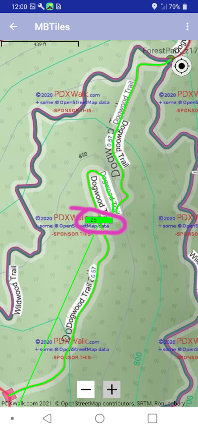
ZigZag Trail
Link to page with free promo codes for PDXWalk app:
PROMO CODES PAGE (updated July 22, 2023)
Updated Maps in August 2022.
Added User Data Deletion page August 4, 2023.
(September 13, 2022) I created a little video trying to explain the two types of data files used by my PDXWalk hiking app. A user would need to download them first, before heading out offline.
Email feedback here: Ron Ledbury.
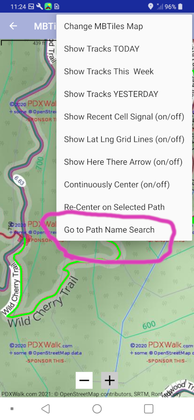
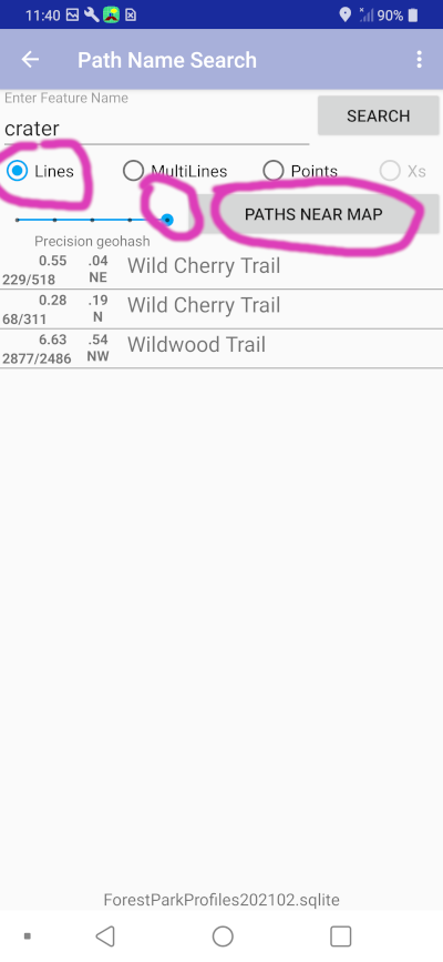
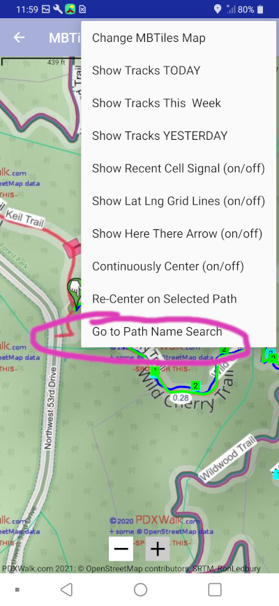
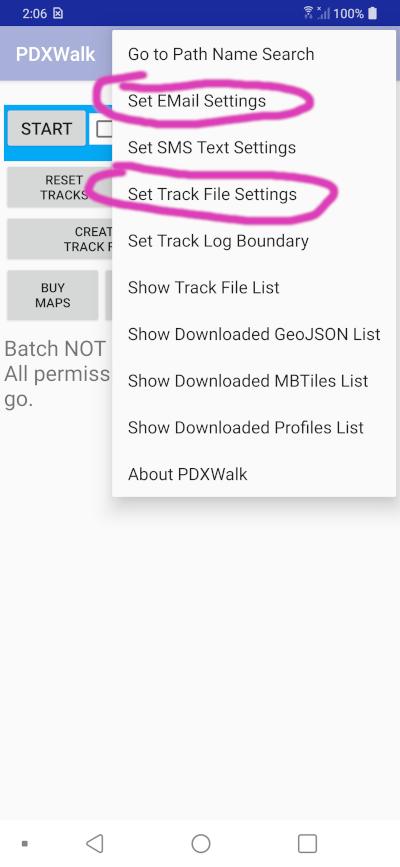
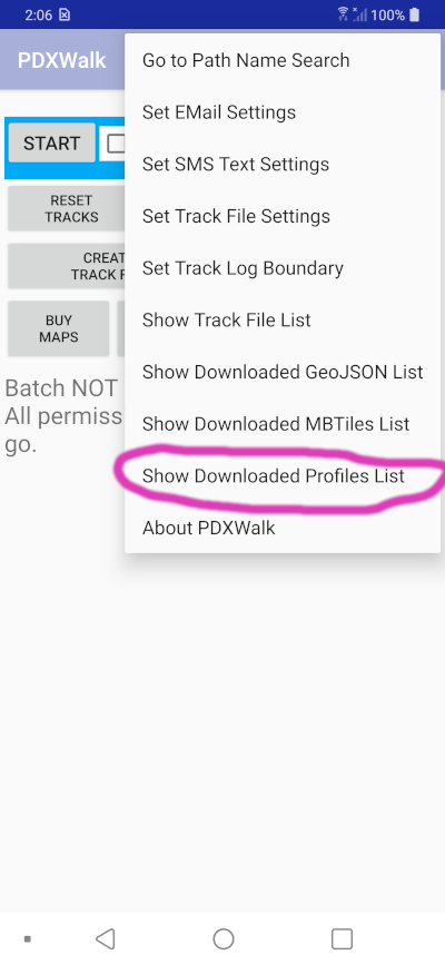
Added web page to help explain the app's Path Name Search page.
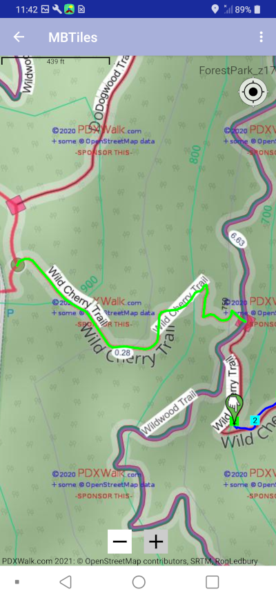
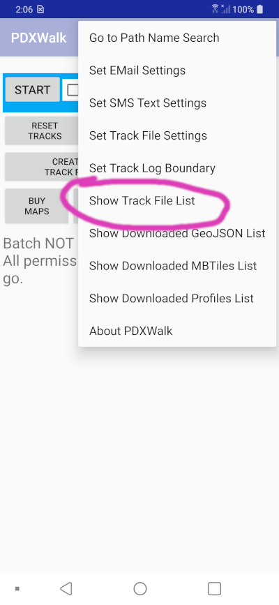
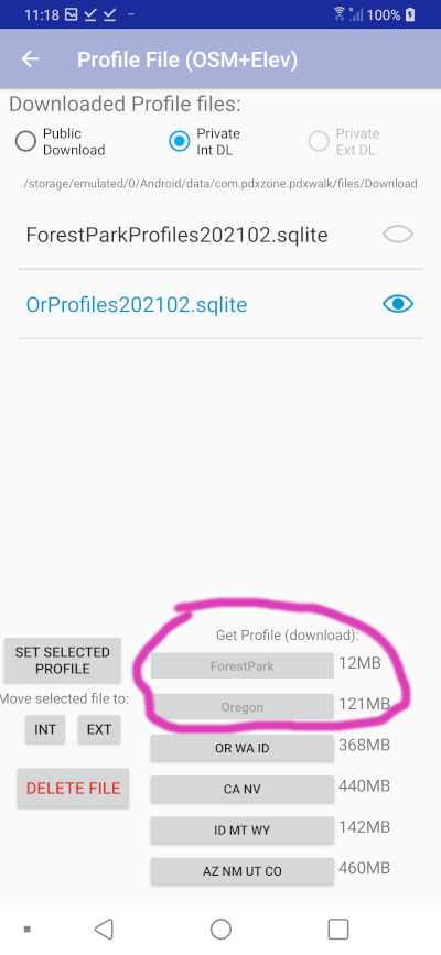
I now have Profiles files with vector data, including elevation data. Turn on the breadcrumbs menu option when on the MAP page. Provided you have downloaded and selected a Profiles file. My breadcrumbs include nearby paths and selectively some roads near center of the MAP, and not just a single GPS track.
video 1
video 2
(back to old instructions . . .)
|
|
|
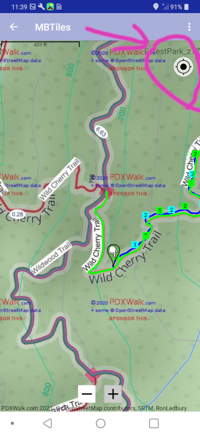
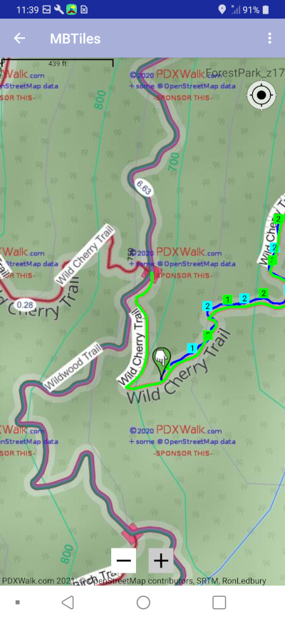
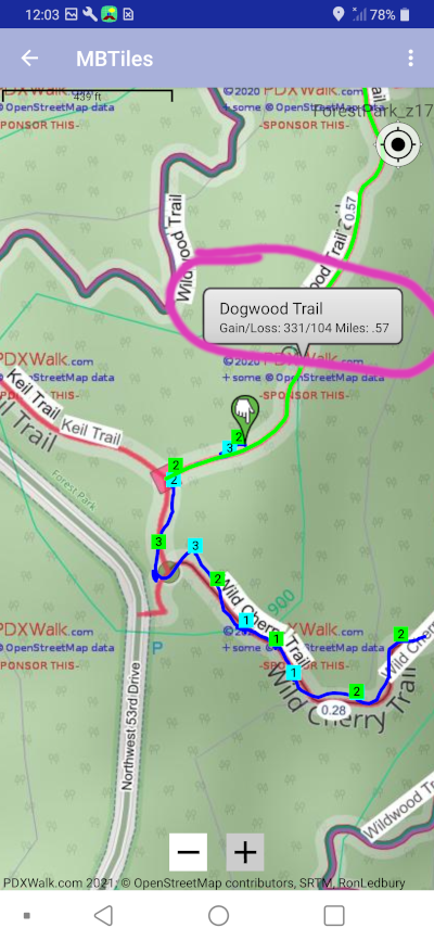
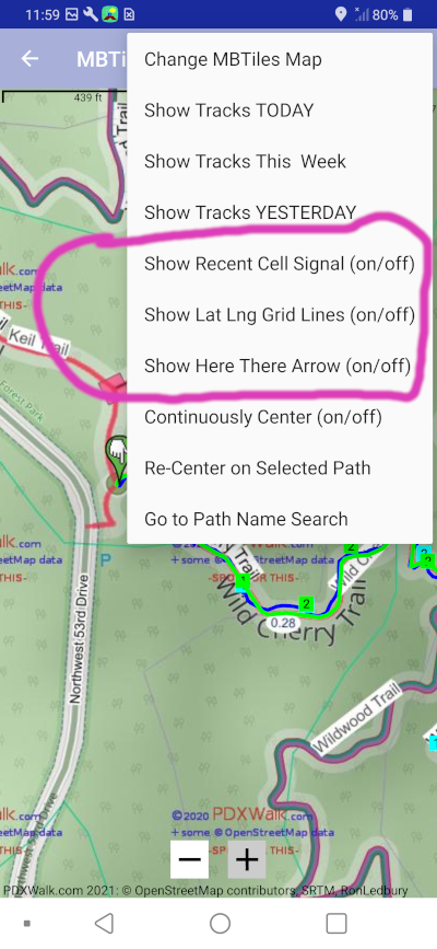
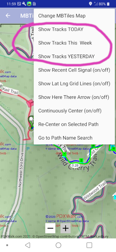
Blue line above is drawn from most recent track points. Little blue and green squares with 1s and 2s are from optionally gathered and displayed cellular signal strength data in number of bars.
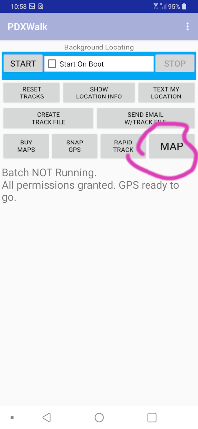
Note: You will first have to get a MBTiles map and then choose one to display in MAP, otherwise you will only see a blank map and maybe your blue line for recent tracks. Keep reading to learn how to set it up.
|
|
Note: Search text is ignored when we |
|
|
|
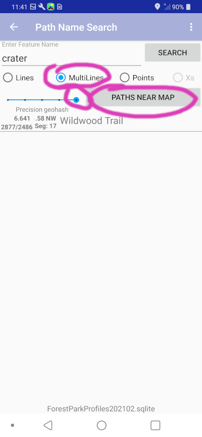
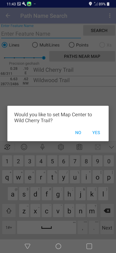
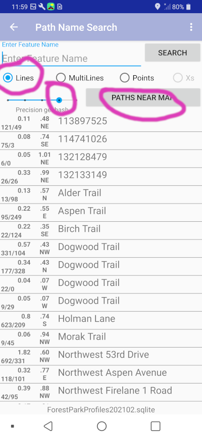
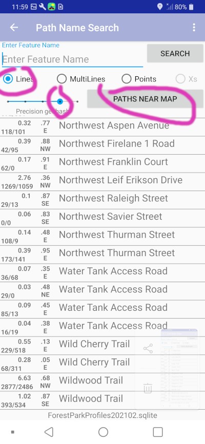
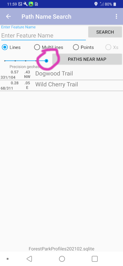
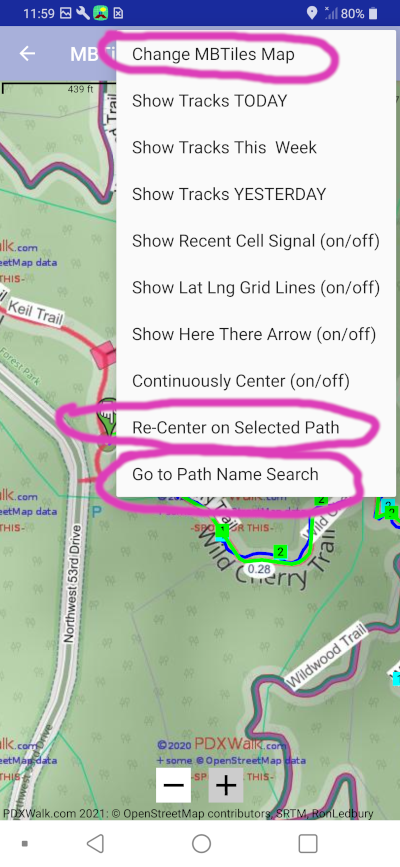
This Path Name Search feature is designed by me for me when I get lost. All I want to know then is how can I get out. Is there a nearby forest road, etc?
|
|
|
|
|
|
|
|
|
|
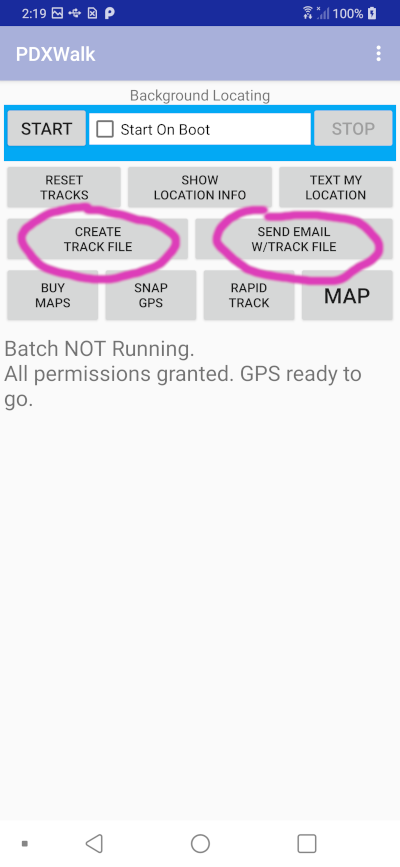
When finished, you can let it expire or go to the Rapid Tracking page again and stop. When I test I start many devices before hiking, then stop them at the end of hike. (Must look silly as I keep pulling devices out of various pockets, one after another.) |
|
|
Note: Android has greatly improved the ability to gather these points without burning up all your battery power. But, the original "Background Locating" feature, potentially always on, now only collects data points every 5 to 15 minutes or so and delivers them even less frequently to the app. To be useful now you have to invoke "Rapid Tracking." |
|
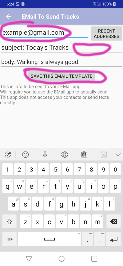
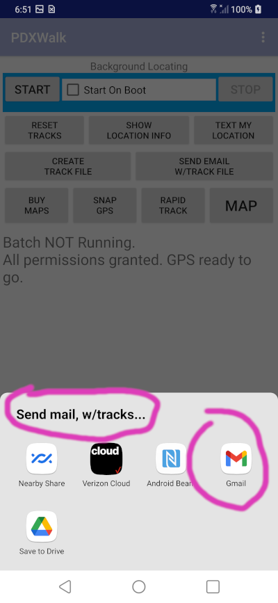
The setup is specifically designed to thereafter make it easy to simply tap the "CREATE TRACK FILE" button, and be done. Or, following that to tap SEND EMAIL W/TRACK FILE to craft an eMail with that GPX track file as an attachment ready for you to send to someone.
|
|
|
|
|
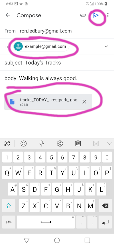
I usually just hit the blue send button to send to myself. |
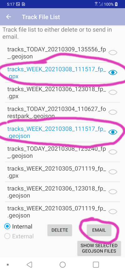
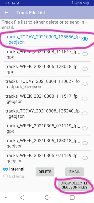
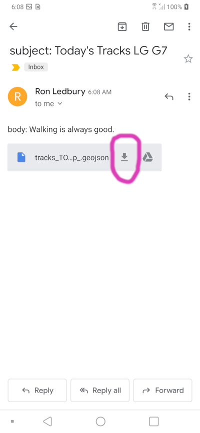
Note:: When GPX track files are created an .geojson file is simultaneously created.
|
[TODO: Looks like I need to sort this list.] |
|
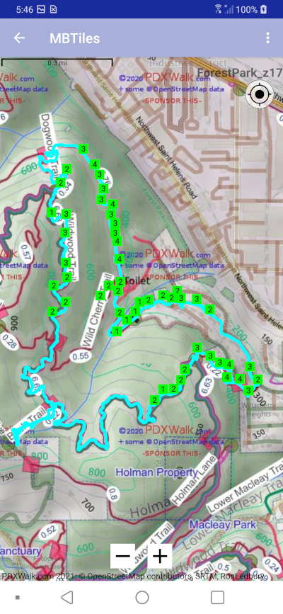
Note:: The cell signal strength markers optionally displayed here are just a subset, filtered based on proximity to center of MAP. |
Here I sent myself an eMail with the same Forest Park hike displayed above.
|
|
This would draw the same track as that above in Forest Park. |
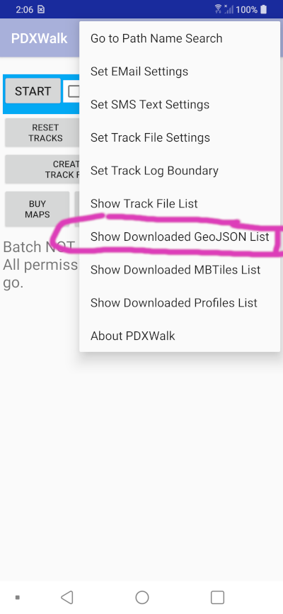
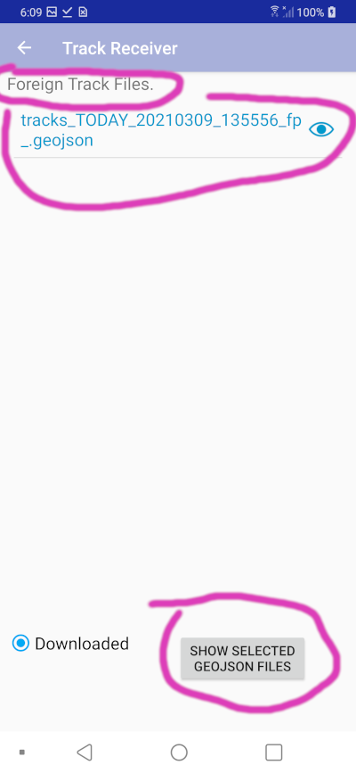
Note: GeoJSON files output by PDXWalk have just one line feature. The GeoJSON schema enables much more and some folks output huge files. The PDXWalk app cannot process files from other programs. Note: "Track Receiver" page name is a left over from failed effort to have email app send my app the geojson attachment. Searching the shared Download folder seems to achieve the same end -- displaying someone else's track that they sent us. Note: You can also download eMail attached GPX and GeoJSON files into the Download folder of your personal computer. From there you can drag the files over the free program GPXSee for display. |
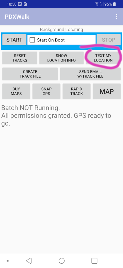
This was one of the earliest features, for me to tell someone where they could pick me up.
|
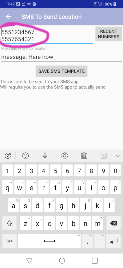
You can list up to ten numbers separated by commas. |
|
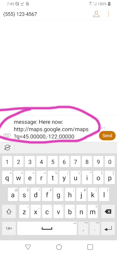
You can modify the text, etc. just you can when creating any text message. |
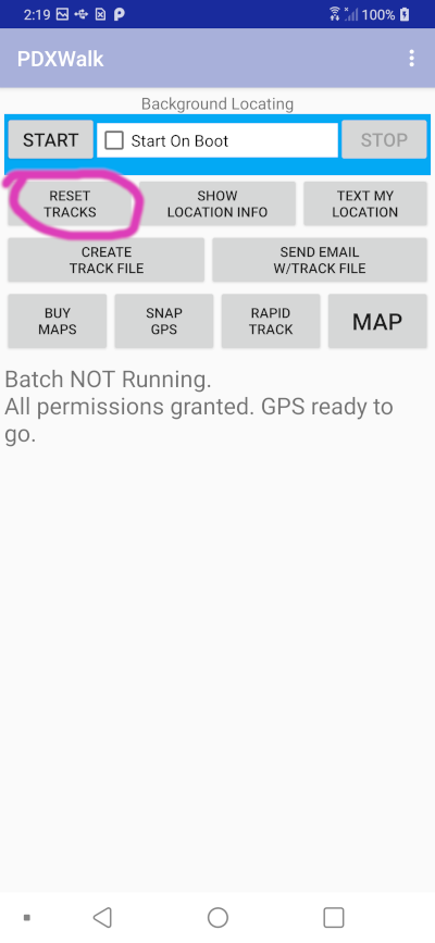
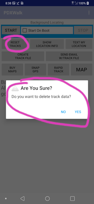
If you accidentally hit RESET TRACKS you will be asked to confirm deleting them.
|
|
You can choose to SEND EMAIL with location. Then from within your eMail app you can attach a file, and it may conveniently list your most recent photos to add to your eMail.
|
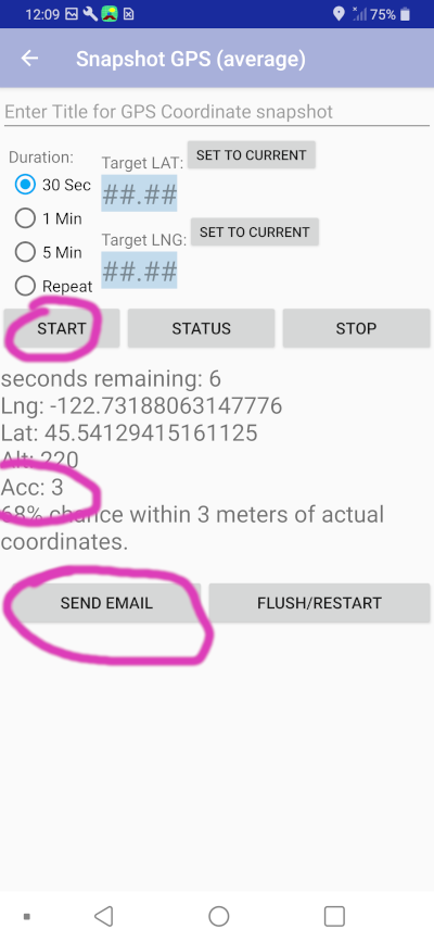
I watch the "Acc" number waiting for as low a number as possible, i.e., the most accurate. |
I use the SET TO CURRENT buttons when at corner post of a piece of property. I can then try to walk straight east west north or south from that point. It lists some data as I walk to say how close I am to the latitude or longitude line. I can't imagine anyone else using that feature.
|
|
|
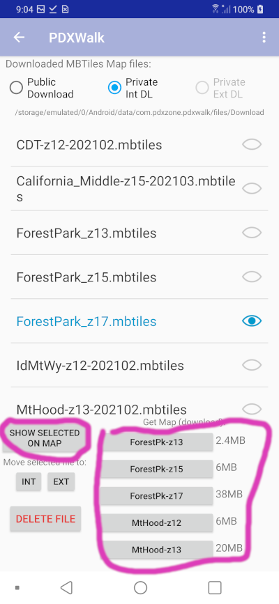
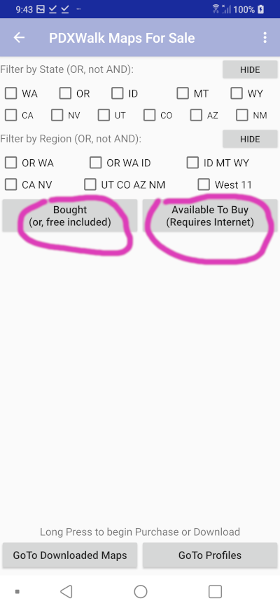
If it all works for Forest Park and for Mt Hood why not do more? Eleven western states. Z## (zoom level) is all important. As you zoom in more the file size can triple in size. The focus for PDXWalk is offline walking, so the maps only zoom in near paths. Find paths by looking for red lines on maps.
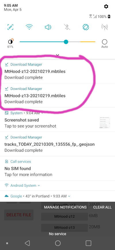
Note: Downloading requires a Long Press on the list, and a confirmation. Files can be very large and you will likely want to be near good WiFi. You will be asked too confirm that you want to start download.
|
|
|
|
|
|
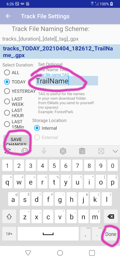
One of these Profiles files must be downloaded and then set as default for Path Name Search to work. Enough data is contained in them to draw a nice profile image, even though I have not yet finished that feature. Raster maps show elevation contour and hill shading so that makes it partially superfluous.
|
|
|
|
|
|
Feel free to contribute to Open Street Maps. Contributions might then show up here in a new replacement series of maps in a year or two. [Note: Strava also uses OSM data. See their how-to-contribute-to-OSM link]
Be sure to try to download purchased maps within a year. If you have more than one device with the same google play account you can download to that other device too.
This is intended to be complete with a one time investment that is good for many years. (Maybe you might add a map or two later.) Data used for the Maps may change over time, but likely not so much that you can't wait several years before upgrading to a new series. I plan to have a reduced price scheme working to Update maps to a new series. The Android platform and development tools have already killed earlier code several times during the last five+ years since I started playing with this code. I have no control over whether they might make some catastrophic change again that mandates significant recoding.
Logging of tracks is limited to within the lower 48 US states.
SRTM elevation data has a gap in, of all places, the part of the Grand Canyon where the Arizona Trail runs through it. Contour lines and hill shading become useless at that spot.
I look forward to the story of "I was lost. Then I remembered I had this PDXWalk app installed on a cheap old Android phone as a back up tucked away in my pack. I was not lost any more."
Two ways to become a tester (April 8, 2021):
Link: How To Redeem Android Promo Code
You should always carry a printed map. Electronic gadgets and the programs that run on them are guaranteed to be fickle at precisely the time you need them the most. There are plenty of places to get printed maps. I'll point you to HikeOregon.net to possibly find a printable map. I'll call that site's hikes curated because the author actually hikes them. See great pictures and trail descriptions. Always use common sense. Sadly, having a map on a gadget takes some the original thrill and terror of being lost (temporarily) out of the experience. Knowing exactly which way to go at a fork in the trail, with no signs anywhere, is a weird feeling.
Find me on Twitter at LostRat
Maps zoom in only near paths.
PCT means Pacific Crest Trail and CDT means Continental Divide Trail. Available at zoom levels 12 14 and 16 for each. PCT map includes John Muir Trail. These specialized maps only zoom in at the trail (and some nearby trails and tracks). Pair them with multi-state maps, for example, to see more detail on trails and peaks away from the PCT or CDT.
California_North and California_Middle are split at a Latitude just north of Lake Tahoe, with some overlap.
California_Middle and California_Bottom are split at a Latitude near Tehachapi, with some overlap.
California north/south split is now based on OSM split for norcal and socal. Latitude about 35.79.
The expectation is that you might get 2 or 3 maps, and have them to use for many years WITHOUT any annual subscription. If you get more than one Android device or change devices you might have to re-download. Google Play store conveniently keeps track of your purchases.
Pre-Android-11 devices are limited to 4GB files. Most older devices have very limited space. These factors influenced the choices below.